

Interior Mapping Software: What It Is, What It Enables, and Why It’s a Must-Have
For decades, interior mapping software has been something facilities and operations teams have wanted but couldn’t easily get. The technology existed in pieces, but pulling it together into something practical meant hiring consultants, gathering data, building custom software, and maintaining it all over time. For most organizations, the cost and complexity put it out of reach.
That’s changed. Today, interior mapping is practical, scalable, and within reach for organizations of every size.
What is interior mapping software?
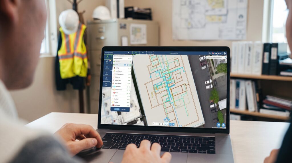
Interior mapping software provides a live, interactive map of everything inside your building. Beyond rooms and hallways, it includes the utilities, electrical systems, plumbing, HVAC, lighting, life safety systems, and other infrastructure hidden behind walls, above ceilings, and below floors, along with the equipment and assets your team works with every day. Each mapped object is connected to its documentation, maintenance history, sensor data, and other operational information, giving your team a complete, real-time view of the facility.
What interior mapping software delivers
Interior mapping software supports nearly every function in a building, from operations and maintenance to safety, space management, accessibility, and wayfinding.
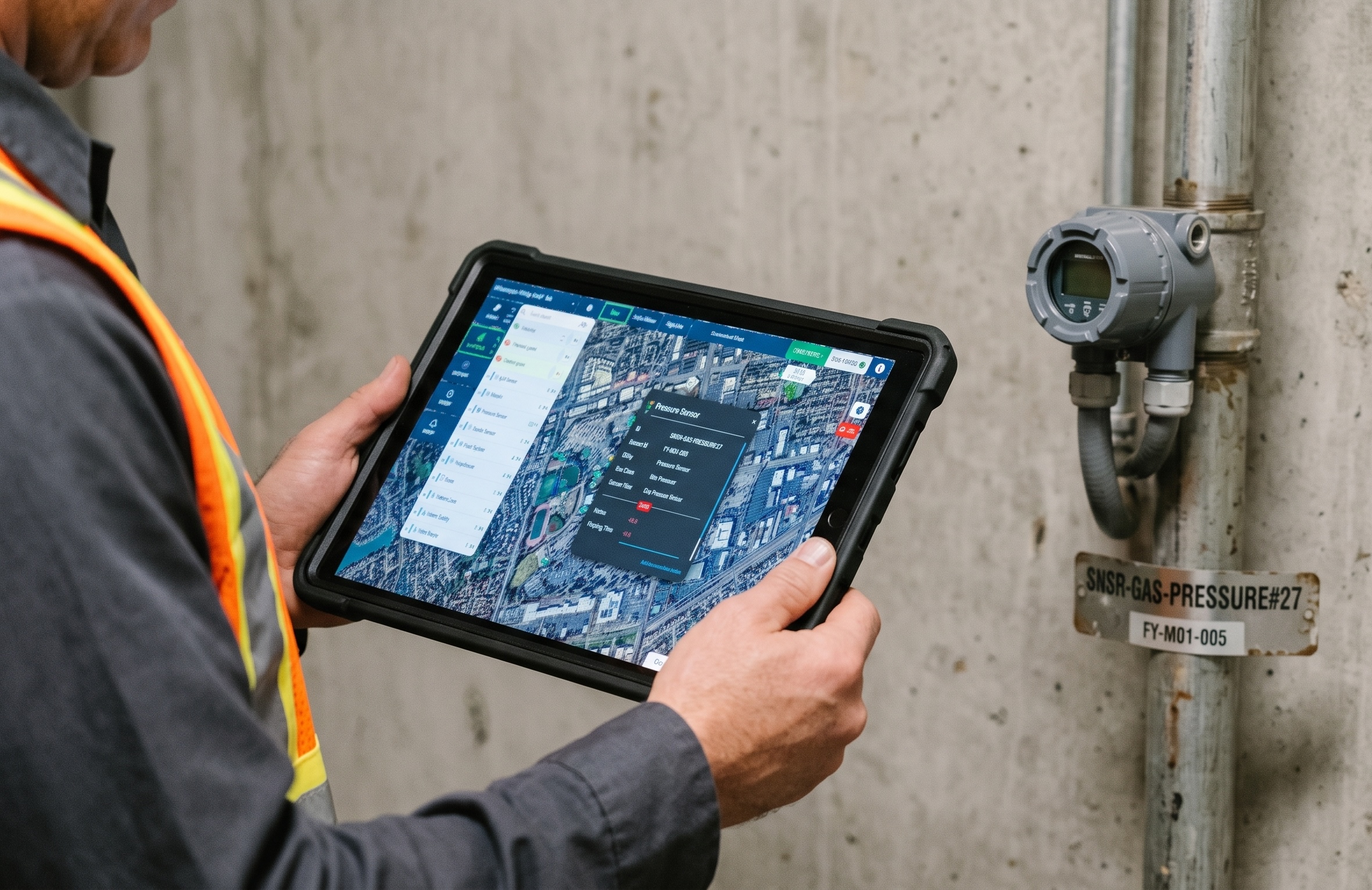
Operations and maintenance. Being able to see utilities, valves, electrical systems, HVAC controls, lighting, and other infrastructure—including what’s behind walls and above ceilings—in a live, map-based view changes how your team works. When a repair is needed, they know exactly where to go and what’s nearby. When an issue is reported, the map immediately surfaces the assets most likely to be involved, giving maintenance teams the context they need to respond faster. Moveable assets such as portable X-ray machines, AV carts, or mobile equipment can also be tracked as they move throughout a facility, giving teams a real-time view of where they’re located.
Safety and emergency preparedness. Knowing exactly where fire alarms, extinguishers, sprinklers, smoke detectors, breakers, and emergency lighting are located means faster, more confident response when it matters most. Emergency evacuation routes can also be mapped and visualized to confirm they’re clear, accessible, and up to date.
Space management. Every space in a building has a purpose, whether it’s an office, classroom, laboratory, storage room, kitchen, or mechanical room. Interior mapping makes it easy to allocate and manage those spaces, understand occupancy and storage capacity, track furniture and equipment, and support moves, adds, and changes. Combined with live sensor data, teams can also monitor real-time conditions such as temperature, lighting, occupancy, and other environmental information that helps facilities operate more efficiently.
Accessibility. Routes that accommodate the full range of your community’s needs—ramps, elevators, accessible corridors—are mapped and navigable, with that information available to the people who need it.
Wayfinding and routing. Unlike outdoor routing, interior routing must account for multiple floors, elevators, stairwells, secure areas, and accessibility requirements. Anyone in the building can navigate from point A to point B, whether within a single floor, across a building, or between buildings on a campus.
Interior 3D visualization. Modern 3D imagery goes beyond traditional photos and virtual tours by creating an accurate representation of your interior spaces that can be measured and explored. Teams can visualize existing conditions, verify clearances, and determine whether new equipment will fit before work begins. For example, before installing a new HVAC unit or other large equipment, staff can measure the available space directly within the 3D view to confirm it will fit without requiring additional site visits.
Why most organizations are still working without interior mapping software
Architects, engineers, and interior designers have long worked with detailed interior drawings. But those drawings were created to design and build facilities, not operate them. Once construction is complete, they typically become PDFs, printed plans, or CAD files that are difficult to keep current and disconnected from the day-to-day information facilities teams rely on.
Revit and other BIM platforms address part of this need by providing detailed 3D models during design, construction, and as-built documentation. But once a building is occupied, facilities teams need something different: a live operational model that evolves throughout the life of the facility. Today’s mapping technology extends beyond construction by supporting ongoing maintenance, updates, and day-to-day facility operations.
As a result, most facilities teams today rely on a mix of workarounds. Some use text-based systems that require you to write out something like: “AC unit 12, second door on the left past the stairwell.” Others have PDFs or CAD drawings that show locations but carry no attributes, no live data, and no workflow. If you need to find an asset, you open a drawing, make an inference about which piece of equipment is affected, and hope the drawing is accurate (and we know it often isn’t).
Older space management systems were expensive, complex to implement, and still presented information as a static picture rather than a live map. You could see where something was drawn, but the drawing and the data lived separately.
The fundamental limitation of all these approaches is that they’re static. With GIS extending indoors and CAD and shapefiles stored in a spatial database, every asset becomes part of a live system. Each asset has its own coordinates, so its location on the map is exact, not estimated or drawn approximately. Updates appear immediately, information stays synchronized, and the map always reflects the facility’s current state.
The technology itself was only part of the challenge. Creating an accurate interior map required collecting information from multiple sources, verifying it in the field, organizing it into a usable system, and keeping it current as the facility changed. Making that information searchable, editable, and accessible across an organization required significant time, specialized expertise, and budget, which is why interior mapping remained out of reach for many organizations.
What InfraMappa delivers
Getting interior mapping right has historically required significant effort: data collection, field verification, software configuration, and ongoing maintenance. InfraMappa handles all of that. We collect your existing documentation, verify it against what’s actually built, fill in the gaps, and deliver a live, always-accurate interior map of your facility. Your team doesn’t have to manage the data or maintain the system because that’s handled for you on an ongoing basis.
The result is a practical solution you can implement quickly and cost-effectively, making interior mapping accessible without the lengthy projects, specialized expertise, or significant budgets that were once required.
Why now
The maturity of mapping technology, combined with InfraMappa’s done-for-you approach, means interior mapping is now practical for organizations of every size. The data collection, verification, and setup that once required months of work and significant consulting costs are handled for you.
Whether you’re managing a corporate campus, hospital, school, municipal facility, or manufacturing plant, InfraMappa’s interior mapping capability gives your team a live, visual understanding of the spaces, infrastructure, and assets they depend on every day.
For existing InfraMappa customers who currently have exterior mapping, adding interior mapping extends that visibility inside your buildings, giving your team, your contractors, and your community a complete picture of your entire facility, inside and out. For organizations whose needs are focused entirely indoors, interior mapping can also be implemented as a standalone solution, whether for a single building, a standalone clinic, a manufacturing facility, or even a single floor within a larger building.