Resources

Case Studies
Learn how other teams have found success with InfraMappa

Events
Catch InfraMappa at upcoming conferences, sessions, and more

Blog
Get practical tips and helpful takeaways to improve your facility strategy

ROI Calculator
Quickly estimate your potential savings with InfraMappa

Webinars
Learn from experts as they share strategies for smarter facility ops
Featured Insight
Nunc volutpat pharetra consectetur libero duis vitae lectus duis netus purus adipiscing massa.


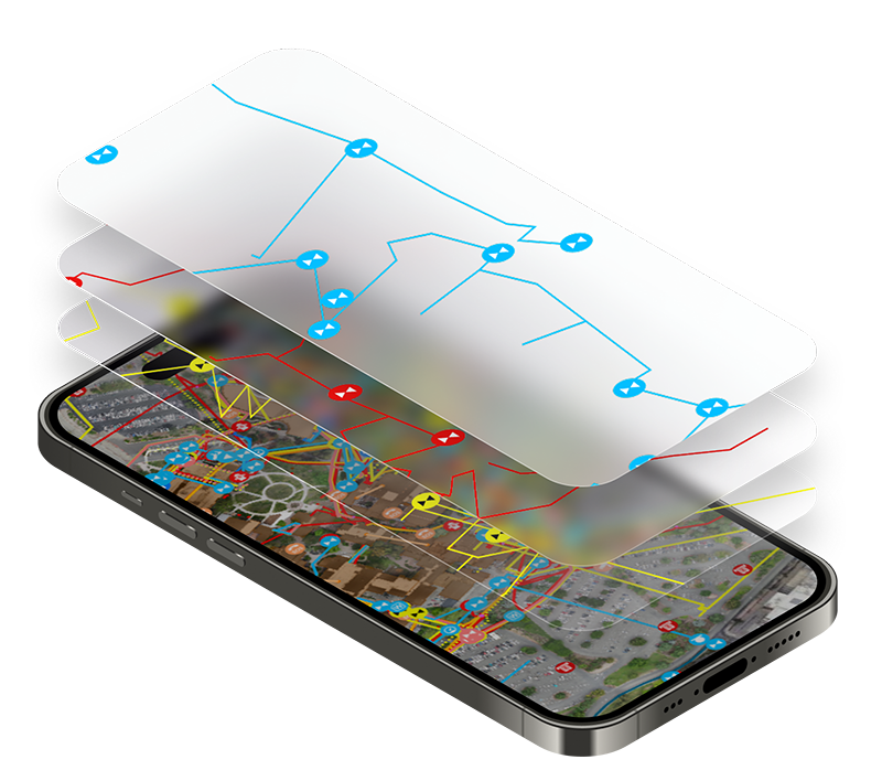
Searchable digital twin
The Only Platform That Turns Scattered Data Into a Digital Twin
One always-accurate platform to see, search, and share all of your facility information. No more paper maps, disconnected digital files, or lost institutional knowledge.


Capabilities
A Single Source of Truth for Your Facility
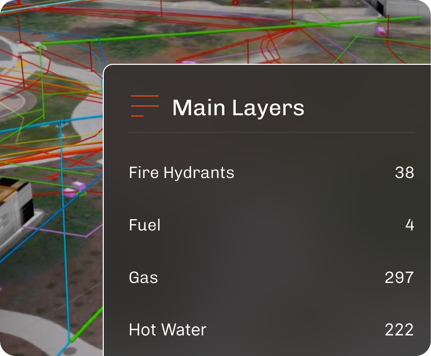
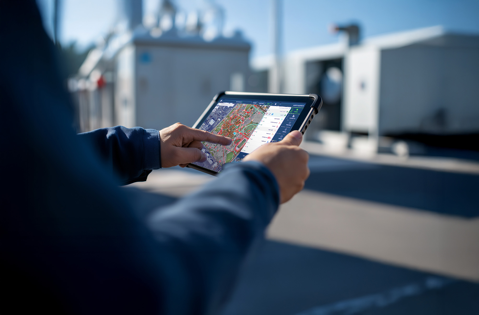
See Everything
See every asset, pipe, and system across your facility with 2D maps and interactive 3D AR/VR views.
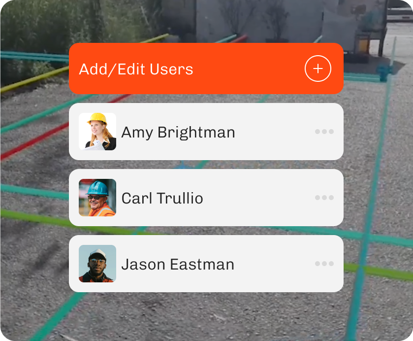
Share Easily
Share accurate information instantly with internal teams and external partners from any device.
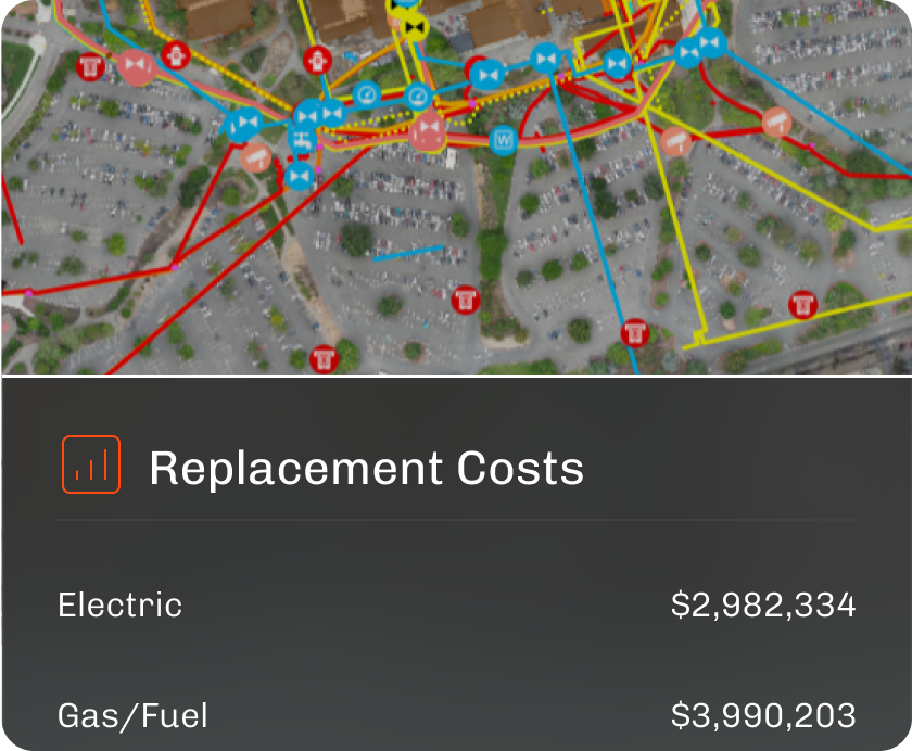
Manage Proactively
Track asset lifecycles, forecast replacement and maintenance costs, and prevent failures with up-to-date, accurate facility data.
Free eBook
3 Signs Your Facility Management Strategy is Stuck in the Past
Download the free ebook to learn the warning signs, and get the three-step roadmap to help you quickly modernize.
watch on demand
From Chaos to Control: The Secrets of High-Performing Facilities Teams
Watch our recent webinar to see how high-performing facilities teams move faster, plan smarter, and make better decisions with the right data.
Areas Supported
Run Lean, Efficient Facilities Teams

Data Management
Turn siloed and scattered facility data into a centralized, single source of truth

Compliance & Safety
Be prepared for inspections, audits, and regulatory reviews with verifiable information

Emergency Response
Slash response times and reduce risk with instant access to system maps, shutoffs, and site details

Capital Planning & Projects
Estimate replacement costs, forecast lifespans, and justify funding with data-backed planning tools.

Construction & Engineering
Prevent rework and project delays by providing easy access to accurate facility data

GIS & Mapping
Power up your GIS with enhanced functionality, field usability, and easy data sharing
INtegrations
Works With the Tools You Already Use
Have systems already in place? InfraMappa integrates with your CMMS, GIS, IWMS, FA, and many others.